
|
| You might also like: | F: GEOGRAPHY | J: GEOGRAPHY | R: GEOGRAPHY | M: GEOGRAPHY | C: GEOGRAPHY | Today's featured page: USA Regional Map/Quiz Printouts |
| Our subscribers' grade-level estimate for this page: 4th - 5th |
 Outline Maps |
EnchantedLearning.com World Geography |
 Flags |
| Africa | Antarctica | Asia | Australia/Oceania | Central America/ Caribbean | Europe | Mideast | North America | South America | USA |
| A | B | C | D | E | F | G | H | I | J | K | L | M | N | O | P | Q | R | S | T | U | V | W | X | Y | Z |
 ABC of Geography Words See if you can think of and write down a place name that starts with each letter of the alphabet. Or go to a sample answer page. |
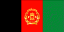 All About Afghanistan Information on Afghanistan, a small, landlocked country in Southwestern Asia (in the Middle East). Do worksheets on the map and the flag of Afghanistan. |
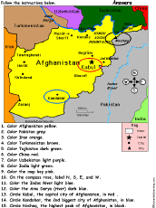 Afghanistan: Follow the Instructions Color Afghanistan according to simple directions, such as, "Color the Indus River light blue." Or go to the answers. |
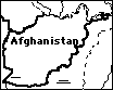 Afghanistan: Outline Map Printout An outline map of Afghanistan to print. Or go to printable activities that require research (using an atlas or other geography reference): a simple map research activity, a medium-level map research activity, or an advanced map research activity. |
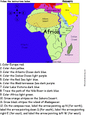 Africa: Follow the Instructions Color Africa according to simple directions, such as, "Trace the path of the Nile River in dark blue." Or go to the answers. |
 African Countries: Label Me! Printout Label the countries of Africa. Answers |
Africa: Label Me! Printout with First Letter Hints Label the countries and bodies of water of Africa, given the first letter of the places. Answers |
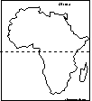 Africa: Outline Map Printout An outline map of Africa to print. |
 African Countries: Outline Map Printout An outline map of African countries to print. |
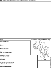 Africa Country Report Graphic Organizer Printout #1 This printout helps the student do a short report on an African country, prompting the student to draw a map of the country, locate it on a map of Africa, draw the country's flag, and write the country's continent, capital city, area, population, name of currency, and language(s). |
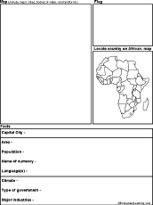 Africa Country Report Graphic Organizer Printout #2 This printout helps the student do a short report on an African country, prompting the student to draw a map of the country, locate it on a map of Africa, draw the country's flag, and write the country's continent, capital city, area, population, name of currency, language(s), climate, type of government, and major industries. |
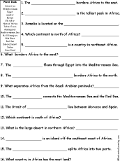 Africa Quiz A Worksheet to Print A short, printable worksheet quiz about Africa. The short-answer worksheet asks general questions about Africa, for example, "What is the large desert in northern Africa? ______." Select the answers from a word bank. Or go to the answers. |
Africa: Shape Poem 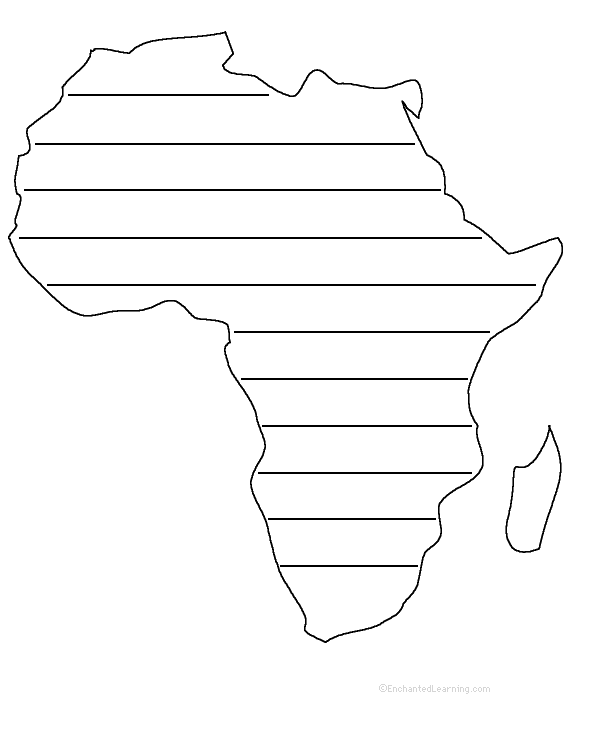 Write a poem about Africa inside the map. Or go to a pdf of the poem worksheet. |
Africa: Perimeter Poem 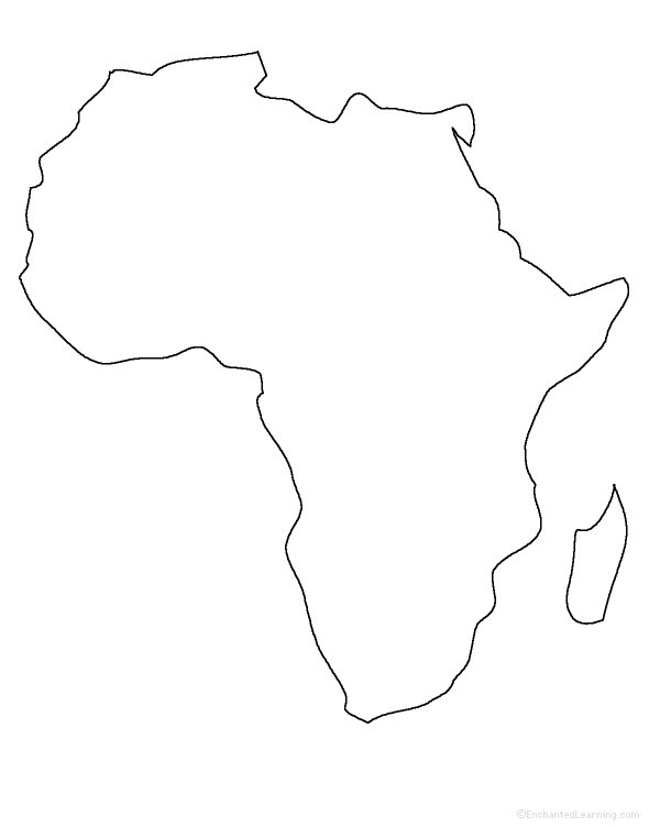 Write a poem around the perimeter (outer edges) of the map of Africa. Or go to a pdf of the poem worksheet. |
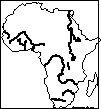 African Rivers: Outline Map Printout An outline map of Africa's major rivers to print. |
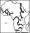 African Rivers Labeled: Outline Map Printout A labeled outline map of Africa's major rivers to print. |
 Africa: Zoom School Use a pictorial interface to get information on Africa. including maps, quizzes, animals, explorers, and printouts on Africa. |
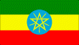 Africa (Flags) |
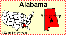 Alabama Alabama is a state in the southern United States of America. Its capital is Montgomery. Map, flag, symbols, printouts, and quizzes. |
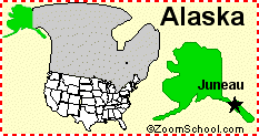 Alaska Alaska is the 49th state of the United States of America. Its capital is Juneau. Map, flag, symbols, printouts, and quizzes. |
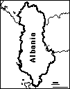 Albania: Outline Map Printout An outline map of Albania to print. |
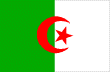 All About Algeria Information on Algeria, a country in northern Africa. Do worksheets on the map and the flag of Algeria. |
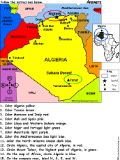 Algeria: Follow the Instructions Color Algeria according to simple directions, such as, "Circle Algiers, the capital city of Algeria, in red." Or go to the answers. |
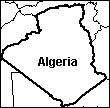 Algeria: Outline Map Printout An outline map of Algeria to print. Or go to printable activities that require research (using an atlas or other geography reference): a simple map research activity, a medium-level map research activity, or an advanced map research activity. |
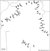 Algeria: Dot to Dot Mystery Map Connect the dots to draw the borders of a mystery country. Then use a globe or atlas to figure out which country you have drawn. You might want to give students clues, such as the continent the country is in (Africa), that it is in the Northern Hemisphere, or that its name starts with "A." Answer: Algeria. |
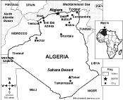 Algeria: Map Quiz Worksheet A printable quiz on the major geographic features of Algeria. The student reads a map to answer 10 geography questions. Or go to the answers. |
 America (USA) Geography Pages Information, maps, printouts, quizzes, etc. |
Nepal panel penal plane Anagrams of Country Names A web page with the names of many countries that are anagrams. Some examples include: China/chain, Mail/mail, Niger/reign, Peru/pure, Spain/pains, Tonga/tango. |
 Match the Country Name Anagrams Draw a line from each country name to its anagram. Words: Iran/rain, Laos/also, Mali/mail, Oman/moan, Niger/reign, Yemen/enemy, China/chain, Angola/analog, Israel/serial, Peru/pure. Or go to the answers. |
eastern earnest nearest plane Geography Anagrams A web page with geography terms that are anagrams. Some examples include: latitude/altitude, nation/anoint, region/ignore. |
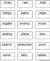 Anagram Puzzle Worksheet - Country Names On this printable worksheet, the student writes a country name for each anagram. Or go to the answers |
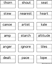 Anagram Puzzle Worksheet - Geography Terms On this printable worksheet, the student writes a geography anagram for each word. Or go to the answers |
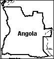 Angola: Outline Map Printout An outline map of Angola to print. Or go to printable activities that require research (using an atlas or other geography reference): a simple map research activity, a medium-level map research activity, or an advanced map research activity. |
 Antarctica Maps, animals, explorers, jokes, fossils, and printouts on Antarctica. Antarctica is an icy continent around the South Pole. |
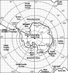 Antarctica: Map Quiz Printout Take a quiz on the map of Antarctica. Or go to the answers. |
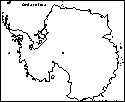 Antarctica: Outline Map Printout An outline map of Antarctica to print. |
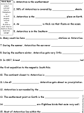 Antarctica: Quiz A Worksheet to Print A short, printable worksheet quiz about Antarctica. The short-answer worksheet asks general questions about Antarctica, for example, "Antarctica is the southernmost ______." Select the answers from a word bank. Or go to the answers. |
Johnny Appleseed Geography Quiz - Labeled Map Take a US geography quiz based on Johnny Appleseed's life using a map labeled with each state's abbreviation. Or go to the answers. |
Johnny Appleseed Geography Quiz - Unlabeled Map Take a US geography quiz based on Johnny Appleseed's life using an unlabeled map. Or go to the answers. |
 The Arctic: Outline Map Printout An outline map of the Arctic to print. |
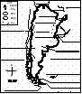
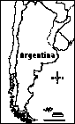
 All About Argentina Information on Argentina, a large country at the southeastern tip of South America. Do worksheets on the map and the flag of Argentina. |
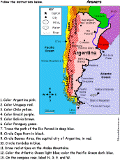 Argentina: Follow the Instructions Color Argentina according to simple directions, such as, "Trace the path of the Rio Paraná in deep blue." Or go to the answers. |
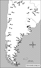
 Argentina: Map Quiz Worksheet A printable quiz on the major geographic features of Argentina. The student reads a map to answer 10 geography questions. Or go to the answers. |
 Argentina's Map: Label Me! Printout Label the map of Argentina. Answers |
 Argentina: Outline Map Printout An outline map of Argentina to print. Or go to printable activities that require research (using an atlas or other geography reference): a simple map research activity, a medium-level map research activity, or an advanced map research activity. |
 Argentina: Dot to Dot Mystery Map Connect the dots to draw the borders of a mystery country. Then use a globe or atlas to figure out which country you have drawn. You might want to give students clues, such as the continent the country is in (South America), that it is in the Southern Hemisphere, or that its name starts with "A." Answer: Argentina. |
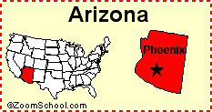 Arizona Arizona is a state in the southwestern United States of America. Its capital is Phoenix. Map, flag, symbols, printouts, and quizzes. |
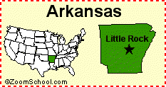 Arkansas Arkansas is a state in the United States of America. Its capital is Little Rock. Map, flag, symbols, printouts, and quizzes. |
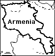 Armenia: Outline Map Printout An outline map of Armenia to print. Or go to printable activities that require research (using an atlas or other geography reference): a simple map research activity, a medium-level map research activity, or an advanced map research activity. |
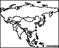
 Asia Information on countries of Asia. |
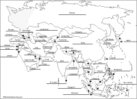 Asia: Label Me! Printout Label the map of Asia. Answers |
 Asia (Flags) |
Asia: Outline Map Printout An outline map of Asia to print. |
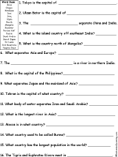 Asia: Quiz A Worksheet to Print A short, printable worksheet quiz about Asia. The short-answer worksheet asks general questions about Asia, for example, "Tokyo is the capital of ______." Select the answers from a word bank. Or go to the answers. |
 Asia: Where I Live A short activity book on geography to print for early readers. There are pages on the Solar System, the continents, Asia, and the student's home. |
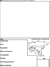 Asian Country Report Graphic Organizer Printout #1 This printout helps the student do a short report on an Asian country, prompting the student to draw a map of the country, locate it on a map of Asia, draw the country's flag, and write the country's continent, capital city, area, population, name of currency, and language(s). |
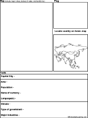 Asian Country Report Graphic Organizer Printout #2 This printout helps the student do a short report on an Asian country, prompting the student to draw a map of the country, locate it on a map of Asia, draw the country's flag, and write the country's continent, capital city, area, population, name of currency, language(s), climate, type of government, and major industries. |
 Asian Rivers: Outline Map Printout An outline map of Asia's rivers to print. |
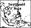 Asia, Southeast: Outline Map Printout An outline map of Southeast Asia to print. |
 Australia Geography information on Australia. |
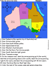 Australia: Follow the Instructions Color Australia according to simple directions, such as, "Color Victoria dark green." Or go to the answers. |
 Australia: Map Quiz Worksheet A printable quiz on the major geographic features of Australia. The student reads a map to answer 10 geography questions. Or go to the answers. |
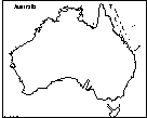 Australia: Outline Map Printout An outline map of Australia to print. Or go to printable activities that require research (using an atlas or other geography reference): a simple map research activity, a medium-level map research activity, or an advanced map research activity. |
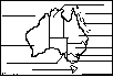 Australia Printout: Label Me! Printout Label the states and capital of Australia. Answers |
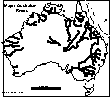 Australian Rivers: Outline Map Printout An outline map of Australia's rivers to print. |
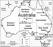
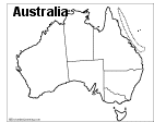 Australian States and Territories: Outline Map Printout An outline map of Australia (with state and territory lines marked) to print. |
 Australian State/Territory Report Graphic Organizer Printout #1 This printout helps the student do a short report on an Australian State/Territory, prompting the student to draw a map of the state, locate it on an Australian map, draw the state's flag, and write its capital city, largest city, area, population, highest point, and mammal emblem. |
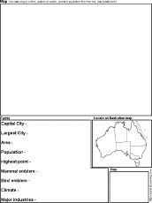 Australian State/Territory Report Graphic Organizer Printout #2 This printout helps the student do a short report on an Australian State/Territory, prompting the student to draw a map of the state, locate it on an Australian map, draw the state's flag, and write its capital city, largest city, area, population, highest point, mammal emblem, bird emblem, climate, and major industries. |
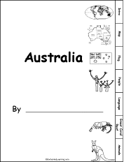 Australia: Tab Book A book about Australia for fluent readers with pages on the map, flag, language, people, the Great Coral Reef, and unusual animals. |
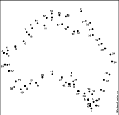 Australia: Dot to Dot Mystery Map Connect the dots to draw the borders of a mystery country. Then use a globe or atlas to figure out which country you have drawn. You might want to give students clues, such as that it is in the Southern Hemisphere, or that its name starts with an "A." Answer: Australia. |
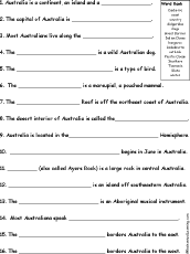 Australia Quiz A Worksheet to Print A short, printable worksheet quiz about Australia. The short-answer worksheet asks general questions about Australia, for example, "Australia is a continent, an island, and a ______." Select the answers from a word bank. Or go to the answers. |
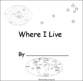 Australia: Where I Live A short activity book on geography to print for early readers. There are pages on the Solar System, the continents, Australia (states and territories), and the student's address. |
Australia: Zoom School Use a pictorial interface to get information on Australia, including maps, animals, explorers, fossils, a quiz, and printouts on Australia. |
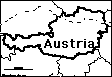 Austria: Outline Map Printout An outline map of Austria to print. Or go to printable worksheets that require research (using an atlas or other geography reference): a simple map research activity, a medium-level map research activity, or an advanced map research activity. |
Australia: Shape Poem 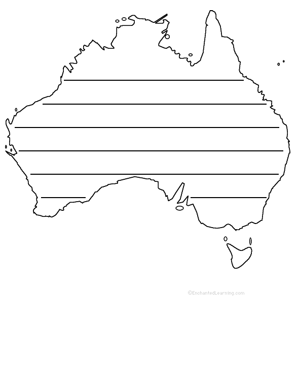 Write a poem about Australia inside the map. Or go to a pdf of the poem worksheet. |
Australia: Perimeter Poem 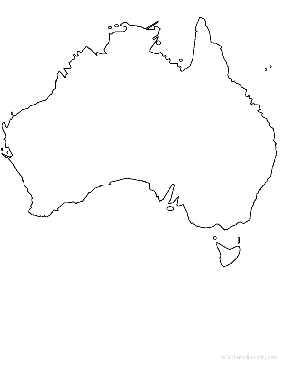 Write a poem Australia around the perimeter (outer edges) of the map. Or go to a pdf of the poem worksheet. |
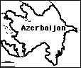 Azerbaijan: Outline Map Printout An outline map of Azerbaijan to print. Or go to printable activities that require research (using an atlas or other geography reference): a simple map research activity, a medium-level map research activity, or an advanced map research activity. |
| EnchantedLearning.com World Geography |
Flags |
| Africa | Antarctica | Asia | Australia/Oceania | Central America/ Caribbean | Europe | Mideast | North America | South America | USA |
| A | B | C | D | E | F | G | H | I | J | K | L | M | N | O | P | Q | R | S | T | U | V | W | X | Y | Z |
Enchanted Learning®
Over 35,000 Web Pages
Sample Pages for Prospective Subscribers, or click below
|
Overview of Site What's New Enchanted Learning Home Monthly Activity Calendar Books to Print Site Index K-3 Crafts K-3 Themes Little Explorers Picture dictionary PreK/K Activities Rebus Rhymes Stories Writing Cloze Activities Essay Topics Newspaper Writing Activities Parts of Speech Fiction The Test of Time
|
Biology Animal Printouts Biology Label Printouts Biomes Birds Butterflies Dinosaurs Food Chain Human Anatomy Mammals Plants Rainforests Sharks Whales Physical Sciences: K-12 Astronomy The Earth Geology Hurricanes Landforms Oceans Tsunami Volcano |
Languages Dutch French German Italian Japanese (Romaji) Portuguese Spanish Swedish Geography/History Explorers Flags Geography Inventors US History Other Topics Art and Artists Calendars College Finder Crafts Graphic Organizers Label Me! Printouts Math Music Word Wheels |
Click to read our Privacy Policy
| Search the Enchanted Learning website for: |
Copyright ©2002-2018 EnchantedLearning.com ------ How to cite a web page